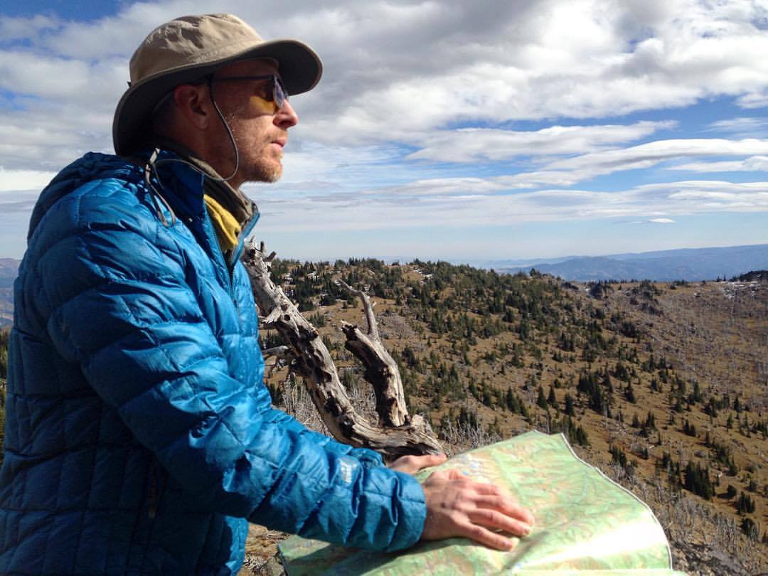

![FourthJulyTr-View[1]](http://wenatcheeoutdoors.org/wp-content/uploads/2016/06/FourthJulyTr-View1.jpg) The elevation gain of this trail is stiff (4,800 feet), but rewarding views start early in the hike and only get better. The final panorama is one of the best in the area, offering views of the Chiwaukum Mountains, Cashmere Mountain, Icicle Ridge, and Mt. Stuart.
The elevation gain of this trail is stiff (4,800 feet), but rewarding views start early in the hike and only get better. The final panorama is one of the best in the area, offering views of the Chiwaukum Mountains, Cashmere Mountain, Icicle Ridge, and Mt. Stuart.
Maps: View our topo map attached (8.5’x11” landscape mode). Note: use ‘Print Preview’ before printing to properly scale this map to a full sheet of paper.
Activity: Hiking
Nearest Town: Leavenworth
Skill: 2 (intermediate)
Fitness: 3 (advanced)
Distance: About 6 miles (one-way) to the old lookout site. Note: the sign at the trailhead states the distance to the ridge is 5 miles, but GPS measurements put this closer to 5.7 miles.
Elevation: Starting elevation: 2,260 feet. Ending elevation: 7,000 feet. Total elevation gain: 4,800 feet.
Recommended Season: Late spring, early summer, or fall.

Access: From Icicle Junction on the west end of Leavenworth, drive south on the Icicle Creek Road (on the western edge of Leavenworth). At 8.5 miles you’ll pass the Eightmile Road and Bridge Creek Campground. Continue onward and a 9.4 miles, you will reach a small paved parking area and the trailhead for Fourth of July Trail No. 1579. The parking area can handle roughly 10 cars if hikers park conscientiously. No permit is required.
Trip Instructions: about 0.25 mile after you start up the trail, you will cross Fourth of July Creek–the last source of water on the hike. Continue up the tight switchbacks until a mile before the crest of the ridge, where the trail will begin to traverse to the east. There is a spring at

about 5400 feet, though there may not be water in late summer. Keep an eye out for rattlesnakes in this area. At 6,800 feet, the trail reaches the ridge crest and intersects with Icicle Ridge Trail (about 5.7 miles from the start). Take a left on this path to climb the final 0.25 mile to the site of the old lookout. You may be tired, but go to the old lookout site –the view is much better here.
Descending. Most people retrace the ascent route back to the car, but a challenging alternative is to complete the Icicle Ridge traverse by descending the Icicle Ridge Trail. Logistically this option is more complicated and requires a vehicle or bike shuttle.
More info and condition reports. This guidebook information from the Washington Trails Association is also useful. Links to recent condition reports are linked to this page.
Last updated by Sarah Shaffer October 2017.
Leave It Better Than You Found It. This should be every outdoor user’s goal. Pick up trash left by others, pull some noxious weeds along your route, throw branches over unwanted spur trails, don’t ride or walk wet trails when you’re leaving ruts/footprints deeper than ¼ inch…
Disclaimer. Treat this information as recommendations, not gospel. Conditions change, and those contributing these reports are volunteers–they may make mistakes or may not know all the issues affecting a route. You are still completely responsible for your decisions, your actions, and your safety. If you can’t live with that, you are prohibited from using our information.

