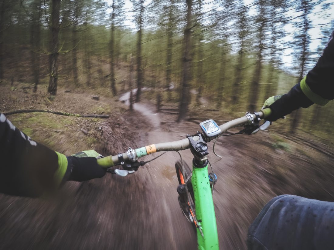

Attractions: There are better rides in the Devil’s Gulch / Red Hill / Sand Creek environs. But after you’ve done the main rides starting from either the Devil’s Gulch or Red Hill trailheads, this ride is worth adding to the repertoire for variety. Variety is, after all, the spice of life. The spices this ride offers? A good cardio workout, little-used and interesting segments of single track on the climb, views of the Enchantments, and a little-used segment of single track on the descent that provides some interesting riding (like branches thwapping you in the face).
Skill: 3 (advanced) for the single track descent
Fitness: 2 (intermediate) 2 plus or 3 minus
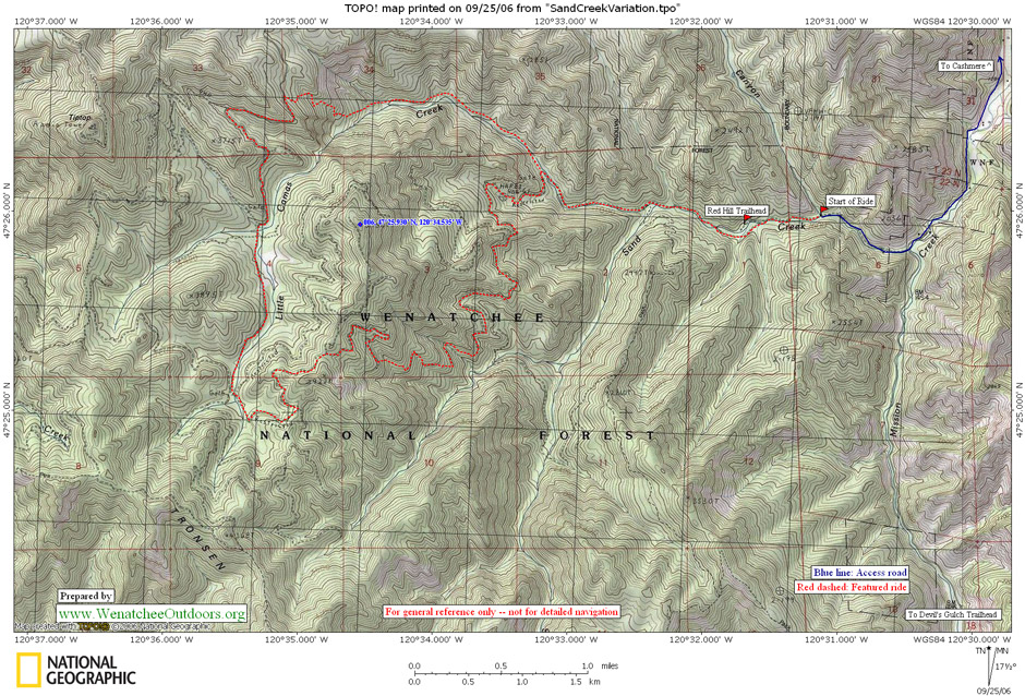
Maps. See map below for more information.
Access:
- Exit Highway 2 at the westernmost Cashmere stoplight. Cross the bridge into Cashmere and at the main intersection in town (flashing light) go straight (you’re on Division Street). In a few hundred yards the road bends to the right around the schools and becomes Pioneer Avenue. Shortly after this bend, turn left on Mission Creek Rd. Go roughly .5 mile and turn right at the T intersection. Cross Mission Creek and turn left at the next road, which is the continuation of Mission Creek Road.
- Now drive 6.2 miles to a Y in the road near where the pavement ends. NOTE: Just as the pavement ends and just before this Y in the road, the property bordering the road is private, strewn with dead cars and junked appliances. No trespassing signs are sometimes posted making, it seem as though you can’t drive the road. Ignore them. This ugly and unfortunate sliver of environmental ruin belongs to an eccentric man the county has prosecuted numerous times. The road is a public and you have every right to use it.
- At the Y in the road shortly after the pavement ends, turn right. Drive about .5 miles and park in any of numerous pullouts alongside the road (free), or drive a little under a mile and park at the Red Hill Trailhead (you’ll need a Northwest Forest Pass to park here).

Trip Instructions:
- Starting from one of the free parking pullouts before Red Hill Trail. Start riding up the road. In about .35 miles you’ll see a gate dirt road on the left about a 100 yards before the Red Hill Trailhead turn left onto this gated road and zero out the odometer. Ride up this new road which has no sign but is called Sand Creek Road.
- Mile 1.55. Sand Creek Road makes a switchback to the left. Note the trail that comes in on your right. You’ll be returning on this trail. Stay on the main road and keep climbing.
- Mile 3.6. At a fork in the road go (elevation 2,500ft) take the smaller right branch. The main road you’ve been on goes left and drops. The right branch you’ll follow contours awhile, and then climbs steadily. This is an old road bed which, through lack of use, has become single track.
- Mile 5.25. The trail has been ridable but for the next few hundred yards the trail is very steep and rutted. Push the bike uphill.
- Mile 5.42. Intersect a much more level road bed. Turn right onto this road bed and start riding again. (Elevation 3330).
- Mile 6.25 (elevation 3,640 feet). You’ve just crested onto a wide ridge with views out toward the Enchantments and hit a T intersection with a larger dirt road. Turn left and start contouring and dropping.
- Mile 7.61 (elevation 3,270ft). Reach a confusing junction with many roads in the general area. At the first part of the junction go around the gate gating the road you’ve been on. Go straight (heading gently downhill). Head for the largest dirt road which is straight ahead of you 100 to 150 yards away. Ignore the smaller spur roads. At the largest dirt road head, which is switchbacking where you intersect it, go right and ride downhill. Ride this major dirt road for several miles.
- Mile 10.35. Pay close attention and turn right on an inconspicuous single track. Immediately after the singletrack is spur road 7200-174. Elevation (3190ft). This single track is fun but it is likely to be fairly rutted, will probably have some deadfall across it, and has two gulley crossings that many riders will want to dismount for. Control your speed.
- Mile 13.23 (elevation 1,810ft). Back to the lower part of Sand Creek Road. Turn left and continue down hill.
- Mile 14.75. Back at the gate across Sand Creek Road. Turn right and return to the car
Permits. A Northwest Forest Pass is required for the parking.
Maps: See our map–not all the road and trail segments used for this road are noted on the USGS map.
Trip Reporter: Andy Dappen, September 2006.
Leave It Better than You Found It. This should be every user’s goal. Pick up trash left by others, pull noxious weeds along your route, throw branches over unwanted spur trails, etc.
Disclaimer. Treat this information as recommendations, not gospel. Conditions change and those contributing these reports are volunteers–they may make mistakes or not know all the issues affecting a route. You are responsible for yourself, your actions, and your safety. If you won’t accept that responsibility, you are prohibited from using our information.