
Statewide, Central Washington’s best-known ride is arguably the Devils Gulch Trail. It’s a great ride, one worth doing multiple times. What is little known is that, from the upper trailhead of this best-known trail, there are a half dozen other excellent rides to enjoy. Some of these rides will appeal to less ambitious mountain bikers because they are either shorter or technically easier. Some of these rides will appeal to really fit cyclists who want to add extra mileage onto a loop of the Devils Gulch Trail. And some of these rides simply represent new territory to explore after you’ve gotten well acquainted with Devils Gulch.
Maps: See our topo map below for more information. (print on 8.5″ X 11″ paper in portrait mode)
Activity: Mountain Biking
Nearest Town: Wenatchee
Skill Level: 2–Some of these rides are 2-plus in difficulty
Fitness Level: 2
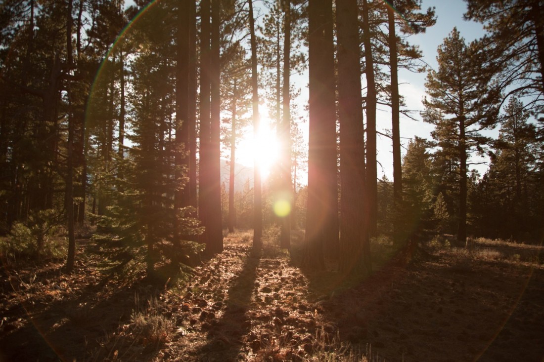
Recommended Season: Most of these trails are shaded and provide good summer options when it’s hot down in the Wenatchee Valley. The area is also very beautiful in autumn when the vegetation yellows.
Access:
- From Wenatchee. Drive up Squilchuck Road toward Mission Ridge. Follow the Squilchuck Road 1 mile past Squilchuck State Park and turn right on Forest Road 9712 (Beehive Reservoir Road). Drive this road about 4.3 miles to the Devil’s Gulch Upper Trailhead.
- From Cashmere. Exit Highway 2 at the westernmost Cashmere stoplight. Cross the bridge into Cashmere and at the main intersection in town (flashing light) go straight (you’re on Division Street). In a few hundred yards the road bends to the right around the schools and becomes Pioneer Avenue. Shortly after this bend, turn left on Mission Creek Rd. Go roughly .5 mile and turn right at the T intersection. Cross Mission Creek and turn left at the next road, which is the continuation of Mission Creek Road. Now drive about 6.2 miles to a Y in the road near where the pavement ends. Near the end of pavement and around this Y in the road, the private property bordering the road is strewn with dead cars and junked appliances. ‘No trespassing’ signs are visibly posted making it seem as though you can’t drive the road. Ignore them, this is a county road. Take the left branch and follow Road 7100 along Mission Creek for about 2.75 miles to the Lower Devils Gulch Trailhead.
- To reach the Upper Devils Gulch Trailhead from the Lower Trailhead, drive 2.25 mile to a fork and go right staying on Road 7100. At 8.6 miles from the lower lot, remain on Road 7100 by going right at a 5-way intersection. In about another mile Road 7100 ends, turn right on Road 9712. About 11.2 miles from the Lower Trailhead, turn off Road 9712 into the upper trailhead (el 5,000 feet).
Trip Descriptions:
Most of these rides are already described elsewhere in our guidebook. Below we’ve given you an overview of the ride and a link to our more detailed guidebook description. These guidebook descriptions don’t always use the upper trailhead of Devils Gulch as their starting point so you’ll need to perform the mental gymnastics of starting and ending you’re ride at a different spot. If you can’t handle that, a little more schooling may be in order.
1) The Beehive Trail provides 4.2 miles (roundtrip) of intermediate single-track riding. This ride starts to the right of the kiosk at the Devils Gulch upper parking lot and runs parallel to the Beehive Reservoir Road (Road 9712) for a half mile before crossing Road 9712 and heading downhill (toward the Beehive Reservoir) through some older forests and through some logged forests. The ride is an out and back if you want it to be all trail. You can also ride the trail down to the lower trailhead and then return to the start on Road 9712.
2) The Devils Spur Trail (aka Devils Tie-In) can be done as an out-and-back ride to provide 5.5 miles of intermediate single-track. The first half mile is the same as the Beehive option described above. At the trail junction take a hard right. This route traverses some loose slopes that are beautiful but exposed–keep your speed under control. Doing this ride as an out-and-back is easiest in terms of navigation, but you can ride the Devils Spur down to the Squilchuck Road, turn right, ride uphill on pavement one mile, ride/push the Clara Lake Trail for 0.3 miles, turn right on the Pipeline Trail, and ride two miles back to the Devils Gulch upper trailhead.
3) The Pipeline Trail is an easy 5.5-mile (round trip) out-and-back ride to the Mission Ridge Ski Area. It’s a great ride for beginners to cut their teeth–and here we mean ‘get experience’ not ‘fly over the handlebars.’
4) The Clara Lake Loop is a 6.5-mile loop with some steep descents. Starts by riding 1.2 miles uphill from the Devils Gulch Trailhead along Road 9712. From a small pullout on the left (no signs) take thehe Squilchuck Trail over to the Clara Lake Trail, descend that trail to the Pipeline Trail, turn left and ride two miles along the Pipeline Trail back to the start.
5) The Mission Ridge Trail is another longer ride that parallels the Devils Gulch Trail but is technically harder. For a brutal day, make a loop of both the Devils Gulch and the Mission Ridge trails without a shuttle.
6) The Upper Mission, Upper Devils Gulch Loop is varied route with roads, trails over lava flows, and smooth forested paths. Ride 1.85 miles uphill from the Devils Gulch Trailhead along Road 9712, take the Mission Ridge Trail downhill for 3.9 rocky miles until it intersects the Devils Gulch Trail, turn right and follow the Devils Gulch Trail (uphill) about 3.1 miles back to the start. Note: Forest Service Maps put the upper portion of the trail at 3 miles rather than our 3.9 miles but this is what our bike computer read — maybe all the rocks knocked our computer senseless.
7) The Red Devil Loop is a top notch, 13-mile loop with plenty of climbing and descending on high-quality trail. The loop connects segments of the Red Hill Trail, Red Hill Spur, Devils Gulch Trail, and Red Devil Trail. Our guidebook information describes the route starting from the Red Hill Trail up Sand Creek (roughly a 4-mile drive from the Lower Devils Gulch Trailhead), but the loop can just as easily be done using the Lower Devils Gulch Trailhead as the starting point.
Cons/Hazards: These routes are varied in difficulty and have different hazards. The Devils Spur Trail has some exposed areas where you don’t want to go flying off the trail. The Clara Lake Loop has some rocky sections and a few pretty steep pitches on the descent. The Mission Ridge Trail also has some steep rolls that are often sandy and tricky to descend. The Upper Mission Ridge Trail is very rocky at the start and will intimidate timid riders.
Fees/Permits: As of 2007, a Northwest Forest Pass was NOT needed for this trailhead.
Condition Update: May 2009. The Mission Creek Road to the Lower Trailhead washed out over the winter and won’t be repaired until 2010. The Forest Service is telling people to park at Sand Creek. Currently we’re not sure how easy it is to park near the washout, carry bikes over the washout, and ride about 2.6 miles of gravel road beyond the washout to the Lower Trailhead. For local residents, the easiest way to access Devils Gulch right now is to access the Upper Trailhead from Wenatchee (see info above).
Leave It Better Than You Found It: This should be every outdoor user’s goal. Pick up trash left by others, pull noxious weeds along your route, disperse old fire rings (they encourage more fires), throw branches over spur trails and spurs between switchbacks (make it harder to do the wrong thing than the right thing).
Important Disclaimer: Treat this information as recommendations, not gospel. Things change, conditions change, and those contributing these reports are volunteers–they may make mistakes, fail to give complete information, or may not know all the issues affecting a route. So forget about finger pointing: If things go wrong, you are completely responsible for yourself and your actions. If you can’t live with that, you are prohibited from using our information.

